Research
The overall research objective of the Madaba Plains Project has been to illuminate the multi-millennial cycles of intensification and abatement in human settlement and land use in the greater Madaba Plains region. To this end, research continues to focus on discovering further details about their nature, particularly with reference to those which occurred during the third, second and first millennia B.C.E. (=B.C.); on uncovering more about their causes and consequences; and on understanding the course of their unfolding through time. To this point, fourteen seasons of excavation and survey have taken place at Tall al-`Umayri and vicinity in Jordan (1984, 1987, 1989, 1992, 1994, 1996, 1998, 2000, 2002, 2004, 2006, 2008, 2010, 2011, 2012, 2013, and 2014). The site is located ca. 15 km south of Jordan's capital city, Amman, along the main highway to the airport. See Hisban and Jalul for results at these Madapa Plains Project sites.
 According to a list of cities from the reign of the Egyptian Pharaoh Thutmose III, the biblical name for Tall al-`Umayri was perhaps Abel Keramim, mentioned in Judges 11:33 (a scarab-seal impression with Thutmose's name was found by the excavations in 1987). During the biblical period the Ammonites apparently controlled the city, making it an administrative center near their southern border with the Moabites. A seal impression, found by the team in 1984, mentions a prominent official of the Ammonite government who served King Baalis in the time of the prophet Jeremiah (Jer. 40:14).
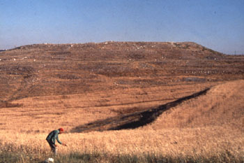
Early Bronze Age — A megalithic dolmen dating to around 3000 B.C.E., excavated in Field K in 1994 on the southeastern slopes of `Umayri, and revisited in 2008, contained parts of 28 skeletons and 20 ceramic vessels, as well as beads and jewelry. Archaeologists have found several use-surfaces, one on top of the other, immediately outside the dolmen that date to the same time period as the burials, as well as additional features associated with what was a memorial tomb. People living at the site evidently celebrated funerary rites at the dolmen long after the burials had begun. There seem to be no parallels among the thousands of dolmens dotting the Mediterranean and European coastlines to this phenomenon of surrounding use surfaces. In addition, also new in the world of Dolmen research, a small, two-room building recently emerged, which may have been used to house those coming to the Dolmen for memorial services. Because an aerial photo in 2012 showed the possibility of an adjacent dolmen foundation, in 2013 ground-penetrating radar and electro-magnetic induction were used to explore the area around the dolmen to see if there are other such tombs nearby. The 2014 season saw the introduction of Field P, adjacent to Field K, marking the beginning of attempts to expand exposure of any dolmen tombs. While failing to uncover more dolmens, the season did reveal an adjacent bedrock feature with post holes carved into it for a shelter.
On the southern shelf, below the acropolis (in Field D), a house with several rooms and ceramic vessels on its floors tells us how people lived their everyday lives in the Early Bronze Age III (ca. 2400 B.C.E.). One of the many storejars found contained over 4000 chick peas (garbanzos) and illustrates the type of food people ate. At the same time, the lack of large amounts of bones could suggest that their diet was primarily vegetarian. The people from this period seem to have been fairly prosperous. One family rebuilt its house several times as its life and circumstances changed over time. When bedrock was reached, six phases of Early Bronze Age (II and III) occupation had come to light. A small storage cave dug into the bedrock constituted part of these phases of use.
Middle Bronze Age — On the northern slope of the tall, where there seems to have been a large suburb, a few patch walls from the Middle Bronze Age (ca. 1600 B.C.E., during the time of the biblical ancestors) were uncovered in Field C. Imported items from as far away as Egypt and Turkey illustrate the large-scale network of trade to which the city belonged.
Field B has produced several MB structures. Inhabitants constructed a massive defense system, including a dry moat and a steep earthen rampart which crested, but did not support a city wall. In the northwestern corner of the tall there was a large MB structure of some kind, perhaps a corner tower to oversee the rampart. Additionally, the large lower wall stones of another building were found inside the city.
Late Bronze Age — In Field B there appeared an extremely rare find for this part of Jordan, architecture from the Late Bronze Age, dating to ca. 1400-1350 B.C.E. Surviving buildings from this period of low population density in central Jordan can be numbered on one hand. Not only does `Umayri boast such a building, but it is extremely well preserved. The highest surviving walls of the five rooms exposed measure over ten feet high. When the structure was first exposed in its entirety, we had begun to use the “P”-word: “palace.”
The 2004 and 2006 seasons, however, turned up an extremely well preserved cultic niche in a free-standing mudbrick/stone wall in the northwest room of the complex which has changed our assessment. The five standing stones, chalices, lamps and other vessels plus poorly fired clay figurines (numbering at least 15) have confirmed the need to consider the “T”-word. We are dealing here with a temple or, at the very least, a building with strong religious influence and use. Excavations have revealed use surfaces several centimeters thick, suggesting worship here for some time. It also became apparent that the northeastern room of the complex served as a large entry hall, complete with two standing stones and a stepped entrance from the east.
The 2008 season saw the completion of our excavations of this building and, with that, Field B has now been officially closed down. We now know the entire extent of the building inside and out, a rounded corner marking its northwest corner and a double-wall along the southern half of the eastern wall, built that way to support the stone stairway to the second story. The function of the building is still somewhat unclear, with dominant views suggesting a "Temple/Palace" or a "Palace/Temple."
In 2012 the cultic niche was dismantled and shipped to the Citadel Museum in downtown Amman for display.
Early Iron I — The early Iron I period (ca. 1200-1100 B.C.E.) is well represented at `Umayri in several locations on the tell, with a concentration of remains located in Fields A and B on the site's western end. The MB rampart, having collapsed due to a massive earthquake, had to be repaired. Inhabitants took on a major rebuilding project, clearing the dry moat and constructing a stone retaining wall and earthen rampart over the damaged one and adding a perimeter wall at the top.
Because of a fiery destruction of the town some time around 1150 B.C.E., many of the buildings inside the 50 meters of surviving perimeter wall were well preserved beneath two meters of mudbrick and burned material. The buildings included what has become widely recognized as one of the earliest and certainly the best preserved “four-room” house (Building B) located anywhere in Palestine and surrounding countries as well as an adjacent building used in part for worship.
Building B, the northernmost of the two, encompassed three “long” rooms separated by rows of stone post-bases anchored in the earth floor. These would have supported several wooden posts which constituted the first-floor wooden infrastructure to a two-story house. The long rooms likely housed farm and pasture animals, as did an animal pen in the courtyard to the east. The back or “broad” room was for storage, as the 75 collared pithoi suggest. The second story, supported again by a wooden infrastructure consisted of mudbrick walls with the family living in the long rooms and storage occupying the broad room. A roof of mud and clay covered the building. The first-story broad room also yielded up military hardware and the fractured, burned bones of at least two individuals who had died on the roof likely trying to defend the town.
The other major structure (Building A) extended across the lines of Fields A and B and consisted of four rooms — a domestic room containing a storage bin, a cooking hearth and a grinding stone and mortar, all on an earth floor; a household center for worship separated by three stone post-bases (likely supporting wooden posts for a curtain divider wall) and including a standing stone and votive altar on a stone-paved floor; a broad-room storage area containing eight to ten collared pithoi; and an alcove to the south with some type of worship function. Seven stones lying side by side likely have fallen from standing positions. Other early Iron I remains in Field A have only recently become apparent with the excavation of several walls, surfaces and rooms dating to this period. At the end of the 2006 season, there still remained a good deal of work to perform in order to expose additional early Iron I architecture. Related to these finds was the thick perimeter wall made of large stones. The wall was plastered in antiquity and, as uncovered by the excavators, stood three to four meters above the ground. It likely stood several meters higher in ancient times.
A third building emerged in 2008, whose walls are less well preserved than either Building A or B. Then a fourth building in 2010 (cleared in 2012). The clear evidence of massive destruction matches that of the other structures, adding to the picture of a huge, site-wide conflagration of immense proportions and intensity. Buried beneath the destruction were the cultural remains of a domestic structure, complete with likely dozens of collared pithoi and a food-preparation work area including grinding implements with attached bench for working in a sitting position.
Exposed portions of the perimeter wall now extend for more than 50 meters on the western escarpment, revealing not only a large curve at the southern end of the exposed portion of the wall, but providing what excavators first thought was evidence of the northern wall of a gateway into the town. A possible southern pier of the gate structure surfaced in 2006, offering a possible western location of entry into the town. However, the work in 2008 has dispelled those hopes, as the stratigraphy does not allow a gate structure in this location during this period. The 2014 season exposed a portion of the Early Iron I rampart in Field J, down the southern slope of the tell.
As a result of excavations in 2010 and, during a small, focused season in 2011, as well as in the 2012 season, an additional "four-room" building has surfaced in Field H on the southwestern part of the tell, characterised by quoin-and-pier interior walls and dating apparently to a few years later than the four adjoining buildings in Fields A and B. Stratigraphic connections have been made between Fields A and H, the massive destruction of the four buildings nearby forming the debris into which the Field H building was founded.
The cultural finds suggest a simple people with a limited repertoire of pottery and objects, reflecting the settlement of local tribal groups.
Late Iron I — A settlement around 1100 to 1000 B.C.E. left remains in the form of a storeroom containing ten to twelve collared pithoi in Field A, destroyed by a fierce conflagration. Field H revealed numerous cultic objects, including almost life-sized ceramic statue parts as well as at least two ceramic shrine models. The opening of one model was flanked by two painted figurines, each having only one breast. Architectural remains–a large paved and plastered surface (with several repairs) plus huge boulders in a row–suggest the sacred precinct of some type of religious structure. Some of this material may date to the very early Iron 2 period.
Iron IIB — The most recent excavations have exposed what appears to be a complete domestic house from around 800 B.C.E. It is well preserved in some rooms, boasting cobbled surfaces, walls nearly two meters high and doorways and hallways.
Late Iron II/Persian — The administrative sector of the Iron II city (Ammonite by this time—seventh through sixth centuries B.C.E.) appeared in Fields A and H and clearly served as a center for administration of the town and region. The center was constructed of walls over a meter thick with deep foundations which destroyed earlier Iron I layers. A sizable complex of buildings from about 550 B.C.E. administered scores of rural sites that were dedicated to wine production in the hills around Tall al-`Umayri. The largest room of the administrative center had three levels of plastered floors and likely served as an open courtyard.
From the evidence available to this point, the latest use of buildings in this administrative area dates to the Persian period. Aramaic seal impressions bear the names of an official (Shuba) and the name of the province of “Ammon.” This is the first solid evidence for the existence of a Persian province of Ammon.
Late Iron II/Persian buildings have surfaced throughout excavated portions of the tell. Field L produced parts of adjacent structures, one of which contained a nicely preserved tabun oven about one meter across; another three large perforated stones used as weights on an olive oil press. Field M also provided us with buildings and surfaces from this time period, but only more excavation here will give us the complete picture.
Hellenistic — Field L, opened originally in 1998, rests along the southern edge of the acropolis of the tell, approximately half way along this side. Excavations suggest a minor settlement here during the Hellenistic period when residents constructed a small farmstead atop much more substantial ruins from the Iron 2 and Iron 1 periods. This small farm may have produced wine on the surrounding hillsides, as well as grain crops in the valley bottoms. The recovery of several complete lamps and juglets, as well as coins, suggests that the residents left quickly.
Roman — Settlers during the early Roman period (at the turn of the era) constructed a ritual bath complex on the top of `Umayri. Given the extremely small number of sherds found in association with the pool, either its builders lived elsewhere (perhaps on `Umayri-East, across the wadi to the east) or there are simply no remains left of the villa which would normally be associated with water installations of this nature.
Modern Restoration — If “telling” is the process by which a tell (tall in modern Arabic) is formed into a complex layer cake of occupations and settlements over the millennia, “untelling” is what archaeologists do when they take a tall apart by means of excavation. At this point in the history of Madaba Plains Project excavations at `Umayri, we must “retell” the story, restore the site so its past can come back to life.
The Madaba Plains Project-`Umayri has launched a major endeavor aimed at consolidating the stone walls we excavate, restoring several of the structures at the site and presenting the site to local and visiting publics. This involves a partial rebuilding of the “four-room” house, construction of pathways and observation towers and establishment of a visitor center housed in a one-to-one-scale four-room house, complete with everything to make ancient life come alive. In addition, there would be a state-of-the-art big-screen video system to run computer-generated clips on various periods at the site in a number of foreign languages.
This effort is currently underway and the project would appreciate any support friends of MPP can provide. Click on "Site Restoration" for more information.